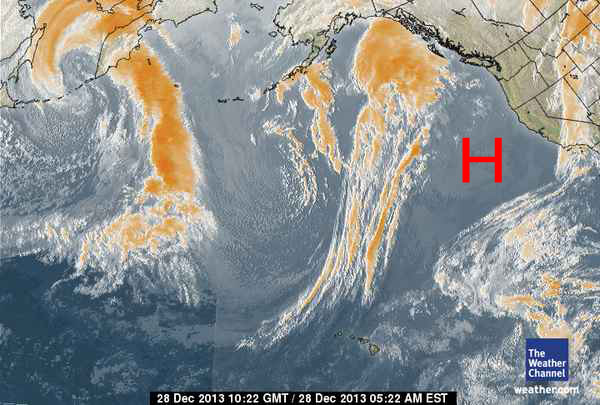
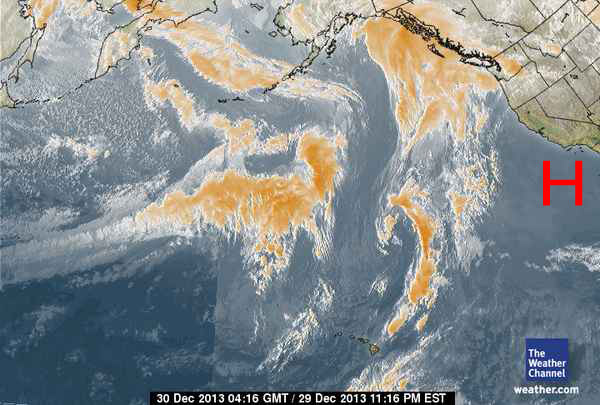
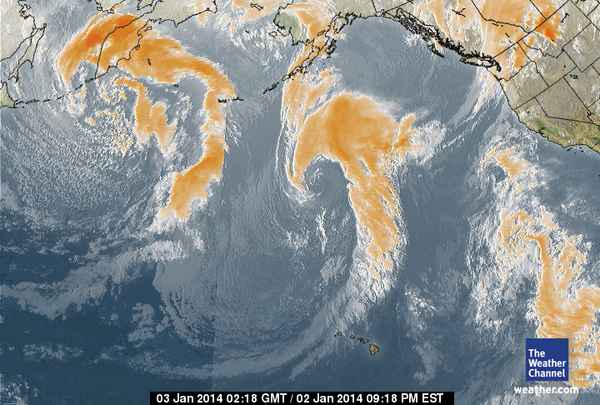
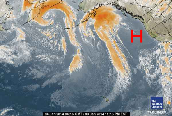
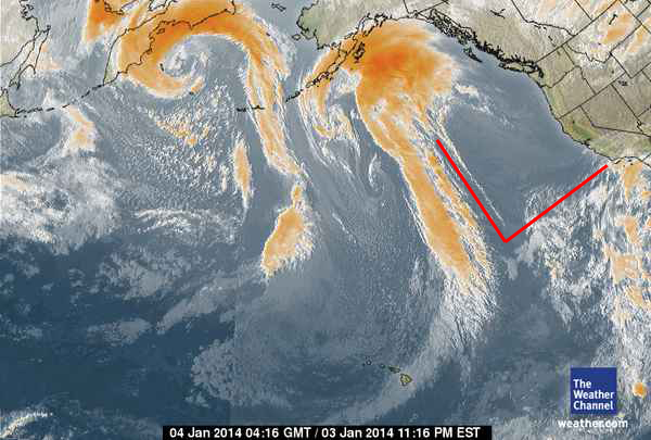
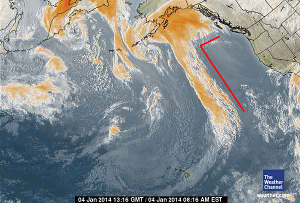
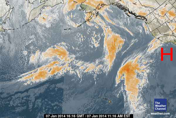
Thanks to satellite weather photos, we’ve been able to observe a persistent, virtually permanent, huge, blocking High Pressure system off the West Coast for the last two months…most of November, December and into January.
We have watched the satellite photos reveal how storm after storm formed up, as usual, in the Kamchatka, Korea and Northern Japan (Fukushima) areas of the North West Pacific.
We’ve watched them move from West to East – like they have always done – to deliver their life-giving rain and snow to keep the US green and verdant. These storm systems, wave after wave, fill our lakes and rivers with water, rain on our vast agricultural lands and cover the Sierras, Cascades and Rockies with snow.
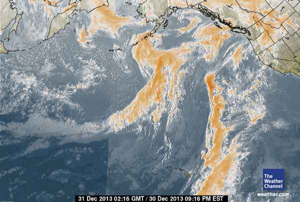
However, for some *strange* reason, not one of them has made it through the immense high pressure blockade sitting off the West Coast this winter. Why? These often robust rain systems run into the High Pressure ‘brick wall’ and are broken down into pieces with much of their water content raining back into the Pacific.
It *might* be these storms are carrying a lot of radiation and ‘someone’ has decided it would be best if they were prevented from getting to the West Coast because if they are carrying radiation, countless thousands on citizens would be measuring and reporting via YouTube, etc, the sudden uptick in CPM rates.
It is widely believed that human emf geoengineering technology can erect and keep high pressure systems in place, if so desired. Is that what is happening to the West Coast… is this an effort to keep Fukushima radiation from blanketing the Western US…even if it is just for the time being?
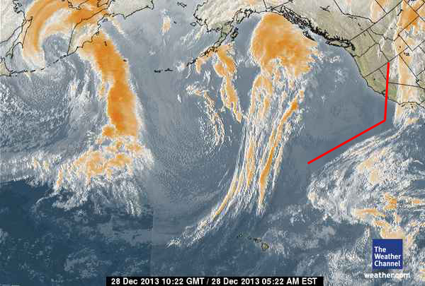
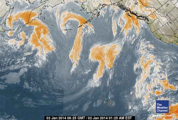
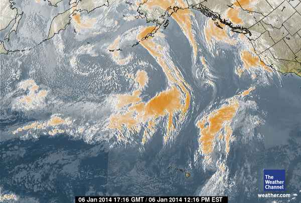
Watch the sequences of date-stamped satellite photos below. Remember also, high pressure systems are round, circular mountains of air spinning in a clockwise rotation. High pressure systems do not lay out in squares or drastic 90 degree configurations. Take a look. Follow the storms as they move from left to right and what happens to them.
Some of the pieces end up being pushed by the Jet Stream up into British Columbia, across Canada and then dropping down into the Central US. That would explain by Geiger counter readings of some of the current snow in Missouri measured 100% over normal background.
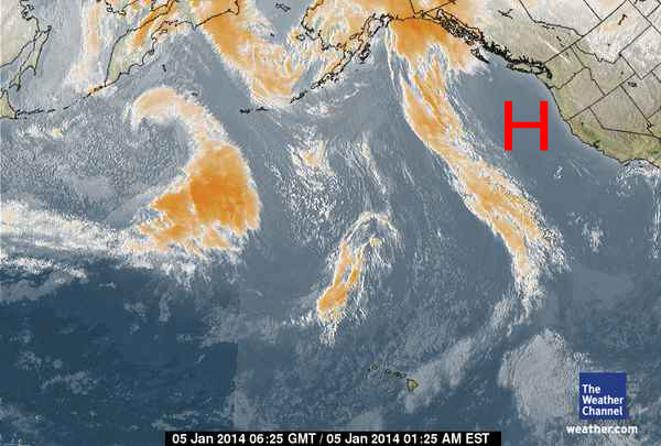
The High Pressure Ridges appear as clear spaces off the West Coast…
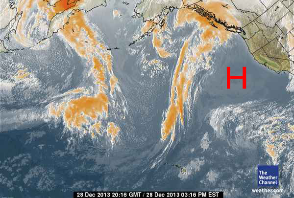

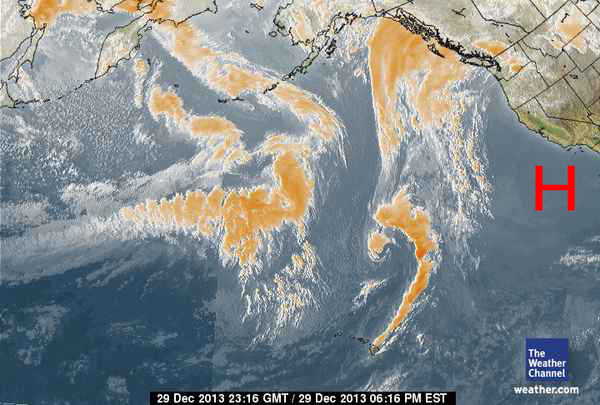
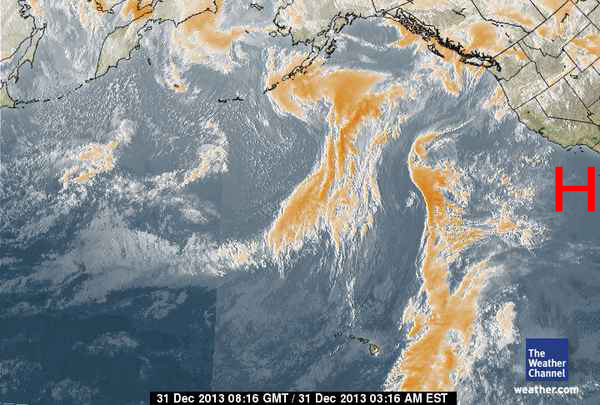
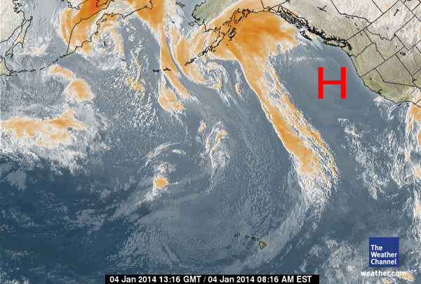
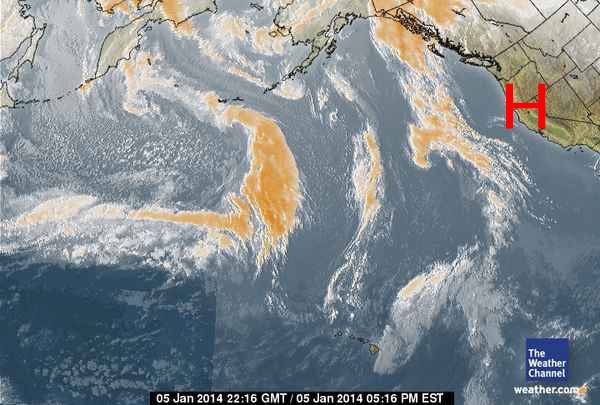
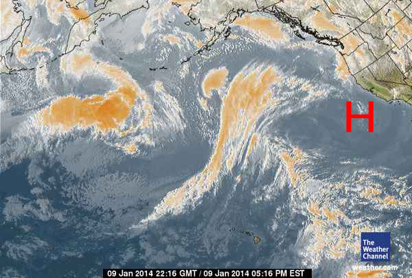
Here we are two days later and you can see the High Pressure is back off California, stronger than ever…

Compelling.
Go to AstralTraveler youtube channel for complete explanation: http://www.youtube.com/user/killerazazello