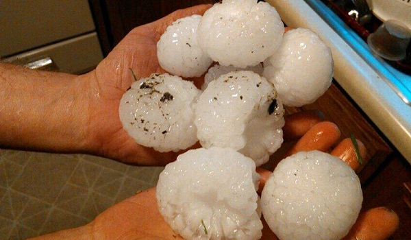
Baseball-sized hail has pounded homes and cars across Nebraska, as powerful thunderstorms swept the Midwest, wreaking extensive damage, severe flooding and even reportedly tornado touchdowns in some areas.
Hailstones the size of baseballs pummeled the state with devastating effect Tuesday, producing a social media storm flooded with images of the aftermath of the freak hail, showing cracked windshields and houses riddled with holes.
Hail northwest of Bayard. Measured at 4.5″. #NEwx pic.twitter.com/AuWBtDMixZ
— KNEB Storm Center (@KNEBStormCenter) June 3, 2014
The US National Weather Service received reports of flooding and registered winds of up to 85 mph in neighboring Iowa. In addition, there were reported of eight unconfirmed tornado touchdowns in Nebraska, Reuters reported.
Damage to the Rath Inn in Missouri Valley Iowa. Roof blown off and lots of windows broken. #WhatAMess pic.twitter.com/KqRb6ITvmO
— Lt. Darci Tierney (@OPDLtTierney) June 3, 2014
The bout of stormy weather has been brought on by a derecho storm system – a short-lived, large cluster of storms – which is expected to move East on Wednesday morning.
Hail damage in Blair, NE via @Michaeldkrueger‘s cousin #newx pic.twitter.com/qLKeXyn7sY
— Adam Peters (@AdamPeters) June 4, 2014
“These storms can knock down trees, cause power outages and travel mayhem for the Wednesday morning commute,” Reuters reported Alex Sosnowski, a senior meteorologist at AccuWeather.com, as saying.
#RT
